Four lines · three hubs
The free bus grid
A heated, frequent, free loop. The bus is free.
This is a proposal. It is an idea for Sheboygan, not a city plan or a decision.
Getting to a clinic, a job, a grocery store, a beach or a friend is a right, like water and light.
Four lines
Schematic. Not to scale. 1 Downtown Hub, 2 Basin Hub, 3 Geode Hub.
- Free Line
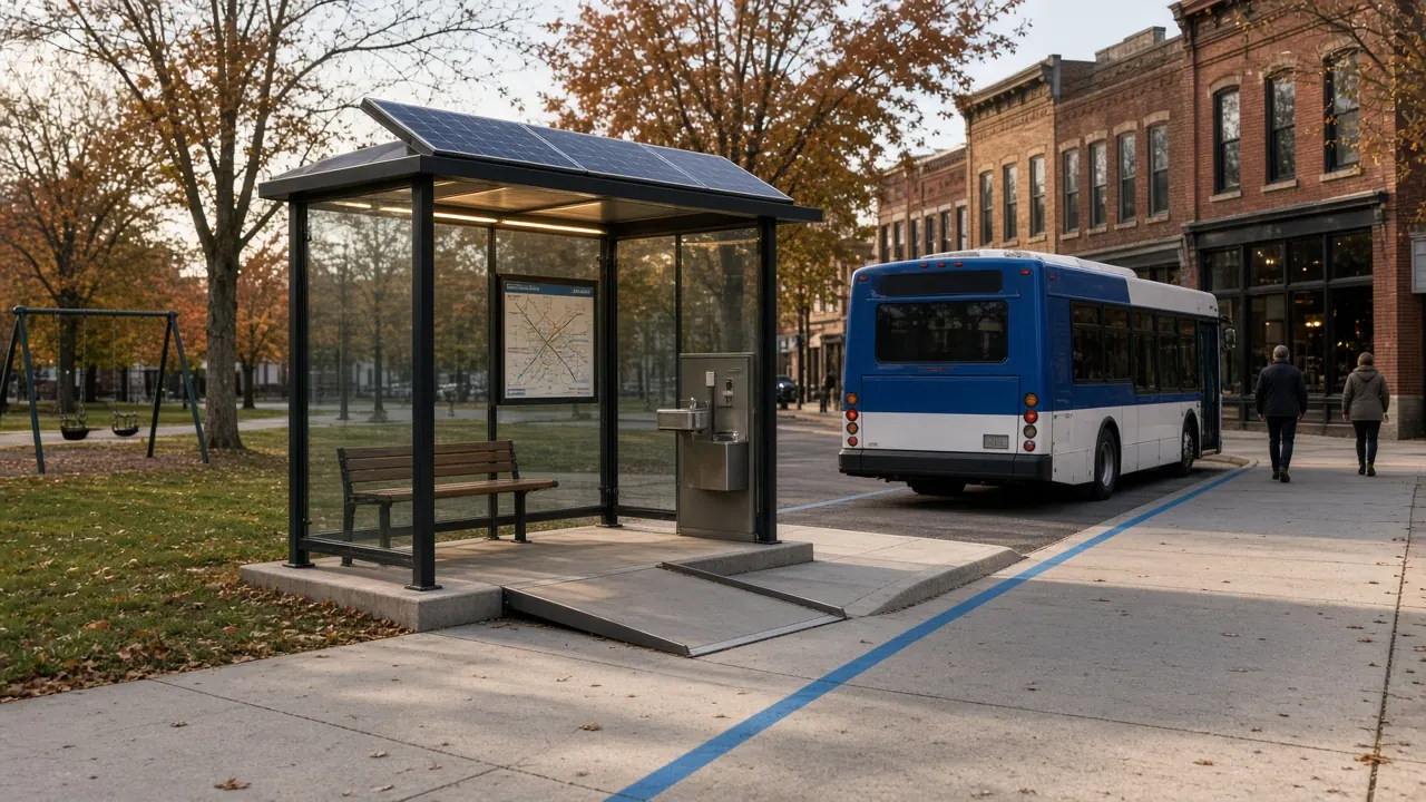
The Free Line: a heated, fare-free electric bus on a loop up Broughton Drive and back on an inland street, stopping at every segment of the promenade. A bus every ten minutes. Every stop: a heated glass shelter with a bench, a map, a drinking fountain and a ramp.
- West Line
West Line: Sheboygan, Plymouth, Fond du Lac. 14.7 miles, then 28.1 more.
- South Line
South Line: Sheboygan, Random Lake, Port Washington. 23.6 miles, then 13.8.
- Flyers
Flyers: an express from a neighborhood stop straight to a big employer, with nothing in between.
A comfortable coach with luggage space, seat power and a bike rack. Start with two round trips a day to Plymouth.
“Four lines” is not a phrase in any source file. The mobility file’s one-page diagram names four: the Free Line, the West Line, the South Line and the Flyers. That is what is drawn here. The same file also describes Pods, Regionals and a bike system, and the one-city master plan draft adds the existing Shoreline Metro trunks. Please confirm which four you mean.
Three hubs
Downtown Hub: the trunk. Every route already meets at the transfer station, a block from the Weill. Both regional lines start and end here under one heated roof.
Basin Hub: the lakefront living room. The Free Line, the Pods and the e-bikes meet here, and the hall is warm all winter.
Geode Hub: the south-bank door and a trailhead for the Swing Trail. A charging plaza goes at the foot of the hill, on flat ground.
More than a bus
- The Pod: the city's own point-to-point vehicle, a small electric car or van you summon with a phone or a button at a stop.
- The Bike: shared and subscription e-bikes, docked at every hub.
- One pass, once a month: every ride on the Free Line, Pods, Flyers and Regionals, an e-bike, and a few car-share hours.
- Four zones: Lake, North, South and West.
The first hundred days are a snow test: if the stops stay clear and the coach arrives in January, it will in July.
For the long version, with the regional distances and a first year in small steps, see the Free Line, in depth.